Shoaling in the Isle of Palms, SC area is posing potential risks to vessels passing through Mile Markers 460 to 461. With many making the trip north on the ICW, and the area having reported depths as shallow as 0.4 feet MLLW, boaters should be cautious. An alternative route exists (provided by Bob423 Tracks) to avoid the 0.4 MLLW shoal entirely.
As of now, there are no plans to dredge Isle of Palms in 2024.
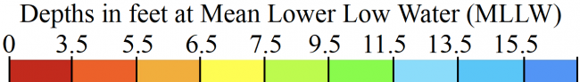
Load the latest Bob423 track for 4.0 MLLW to see the way around the 0.4 MLLW shoal. The 10/17/2023 USACE survey is shown in the photos.
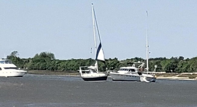
First, the overview photo of the Isle of Palms
The approach to Isle of Palms from the north at MM 460.4 is shown below. Follow the Bob423 track to avoid the 0.4 MLLW shoal on the red side of the channel. The Bob423 track turns to avoid the many shoals here. You have to go outside the channel to find deeper water but then it's only deep to 4 MLLW. There are no plans yet to dredge Isle of Palms in 2024.
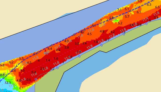
Another option is to take the "detour" route and avoid the 0.4 MLLW shoal entirely by following the red dotted line in the photo for 6.6 MLLW. It can be downloaded here.

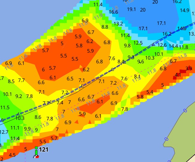
There are more shoals to avoid farther on at MM 461.1. Follow the Bob423 track for 6.7 MLLW as of 10/17/2023

The final shoal before the Ben Sawyer Swing Bridge (going south) at MM 461.5 is shown. In this case, the best path is right in the middle of the channel for 7.1MLLW as of 10/17/2023
USACE = US Army Corps of Engineers
ATONs = Aids TO Navigation such as buoys and daymarks
Aqua Map = a navigation app for Apple and Android devices
Bob423 Long Track = blue dotted line
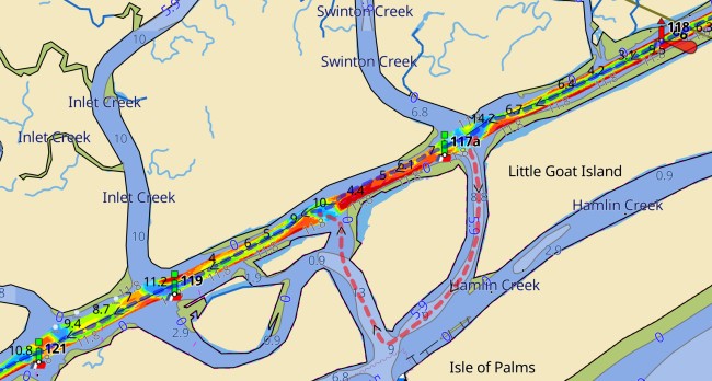
View the Navigation Alert in Explorer


- 4,000 Marinas
- Thousands of anchorages
- Updated Charts
- Mile-by-Mile Navigation
- Highlighted Alerts & Cautions
- Full-Color Aerial Photographs

The Waterway Guide App Makes it easy to leave reviews, use our explorer, and view waterway guide materials all on the go!


