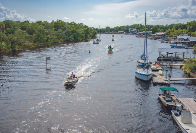
Navigation Notes on the Big Bend
The 350-nm stretch from Anclote Key to Carrabelle across the Big Bend (also called "The Nature Coast") has no protected inside route. To transit the Big Bend area mariners must make the trip across open waters in the Gulf of Mexico. For the second half, from Carrabelle on to Florida's Panhandle, you can travel the GIWW (inside) or continue outside in the Gulf. The more interesting GIWW route connects big bays and sounds that are protected by narrow, wooded barrier islands.
Along the west coast shore from Anclote Key almost to Carrabelle the Gulf of Mexico is relatively shallow and the coastline low and indistinct. It is possible to safely make the Big Bend Passage and never lose sight of land. If you are running along the shore, keep a close eye on the depth sounder and tide charts and the little buoys for crab pots and lobster traps.
This is a fine sailing area but boats with deep drafts should be wary of the shoals and reefs, many of which are oyster bars, some littered with rocks. When sailing in difficult waters for which you have little knowledge and past experience, it may be safer to be farther out than nearer to land.
Brown pelicans are tricky neighbors here. They have a tendency to deface buoy numbers and a pelican perched on a green can buoy may, from a distance, change the outline to that of a red nun buoy. Get in the habit of checking floating marks carefully.
The Coast Guard station on the Withlacoochee River at Yankeetown (about 17 miles southeast of Cedar Key) covers this area and monitors VHF Channel 16. This station also operates and maintains three vessels for emergency search and rescue. In addition to VHF, the station can be reached by telephone at 352-447-6900.
A small change in latitude creates a perceptible difference in the weather of this region compared to southern Florida. The upper Gulf Coast of Florida is the only coastal section of the state that experiences a noticeable winter. Depending on the marine facility and location, the boating season in the Upper Gulf Coast may run from Easter through Columbus Day. If necessary, check with your destinations to determine their off-season operating hours. It gets chilly in the winter but it is still possible to enjoy these uncrowded, clear waters, award-winning beaches and boating-oriented communities.
Choice of Routes through the Big Bend
Planning the trip through The Big Bend starts by making a decision about which route you are going to travel. You can go nearer shore with multiple stops or you can go offshore, traveling directly from Clearwater or Tarpon Springs to Carrabelle.
The nearshore route breaks the trip into multiple legs with daytime travel and multiple nighttime layovers. The trip can be broken into as few as three segments with daily travel of about 70 miles or into as many as seven segments with daily distances of less than 50 miles.
The offshore trip from Clearwater to Carrabelle is about 190 statute miles and as much as 45 miles from shore. A fast boat (averaging 20 mph) can make this trip during daylight hours. A displacement boat (averaging 8 mph) will need an overnight passage of about 23 hours. If you are starting from Carrabelle and going south to Tarpon Springs or Clearwater you should plan your arrival at Anclote red daybeacon "2" or Clearwater green daybeacon "1" after 10 a.m. to avoid early morning sun glare off the water directly in front of you, which can hide crab pot buoys.
Weather is always a serious consideration when boating but it is a primary concern on this trip for several reasons. First, the voyage is over 24 hours long so you will have to look for a minimum of a 48-hour weather window for your trip. Second, "bailing out" is not easy as it may involve as much as 5 hours to get back to land and a potential arrival in the dark through the skinny water that your offshore trip was designed to avoid.
You will need to look at multiple sources of weather information. NOAA's Zone Forecast for the area will give you the general forecast and is a good place to start. Include the 12 hours before and after your passage time in your evaluations. Windy, PassageWeather and Buoyweather are good resources to supplement NOAA. Look for a degree of agreement among the forecasts and acceptable wind speeds and wave heights covering your expanded passage window. The consensus seems to be a 15-mph maximum wind and 2-foot maximum seas are the "no drama" parameters for the crossing. Finding these conditions will require a degree of flexibility in your schedule and a discipline to not push the envelope.
For more detailed information on navigating the Big Bend and the Florida Panhandle:
Purchase a Print Waterway Guide Southern 2023 Edition.
Purchase A Waterway Guide Southern Subscription.
Purchase Waterway Guide Gulf Digital Subscription - Newly revised to include from Sanibel Island, FL to South Padre Island, TX


- 4,000 Marinas
- Thousands of anchorages
- Updated Charts
- Mile-by-Mile Navigation
- Highlighted Alerts & Cautions
- Full-Color Aerial Photographs

The Waterway Guide App Makes it easy to leave reviews, use our explorer, and view waterway guide materials all on the go!


