Long Island Sound packs history, high-tech boating and fun in an estuary that stretches 90 nm between New York City and Block Island, RI. Long and slim-looking on the chart, it is actually up to 20 nm wide in the middle. Much as New York is just "the City," Long Island Sound requires no further name than "the Sound" in local conversation. It's a major commercial artery, an important fishing and lobstering ground and one of the famed cruising areas of the U.S.
Along the northern shore of Long Island Sound, you'll find a string of coastal cities extending from New York to Rhode Island. While many of these cities began as industrial centers because of easy access to shipping and are now populated and diverse urban centers, there are still numerous smaller towns with harbors along the shoreline.
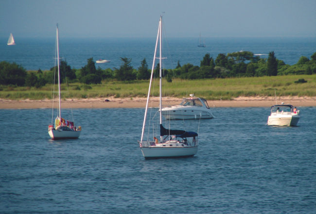
On weekends, the Sound is a wonderland of sailboats producing a spectacular sight. In addition to the parade of cruising boats transiting the Sound, yacht clubs hold organized regattas on a regular basis. These fleets are especially common near City Island, Bridgeport, New Haven and New London under the north shore.
The local mariner need never leave the Sound from year after year. Crisscrossing between Connecticut's rocky shore and Long Island's sandy beaches, mariners cruise the summer away, anchoring in isolated coves, visiting luxurious marinas, racing under sail, fishing, taking long side trips up navigable rivers and exploring big bays.
Cruising Conditions
The weather on Long Island Sound is generally hospitable with the predictable summer thunderstorms. Thunderstorms, of course, bring strong, gusty winds. The occasional nor'easter, often lasting as long as three days, delivers winds, steep seas, low temperatures and torrents of rain. One shore or the other generally offers a lee but a nasty chop is the norm in these conditions. These seas will often continue for a couple days after the sky has cleared and while much reduced, they are still no fun to battle. Heavy fog, which might greet the mariner several mornings a year, can be thick enough to be dangerous, even to experienced mariners. The Sound has an excellent overlapping system of fog signals and it is well charted.
As a rule, in summer months winds pick up in early afternoon and get progressively stronger as the day wears on. Most powerboats wanting to make time get an early morning start or they travel at night when winds tend to die, using the chain of lights that defines a clear path down the center of the Sound. Sailboats may choose to get underway in the light winds of morning, especially if heading south from a river anchorage, before making good time under sail during the breezy afternoons. Check the current NOAA Tide Charts and avoid situations of wind countering current if you want to avoid stiff chop.
Sailors can also set out when the wind is easing and use auxiliary power, if necessary, to run the usually placid night waters. When underway at night, stay well clear of areas where there might be lobster pots, oyster beds and fish traps; all are, at best, difficult to spot.
In addition, keep a sharp lookout for tugs with tows, which often run the Sound at night. The tows are often on very long lines and can be difficult to spot. Especially around the busy port of Bridgeport, tugs can behave rather unpredictably, circling as they bring in or let out their tows in preparation for docking. A radio call on VHF Channel 16 or 13 is advisable to clarify each vessel's intentions. It is not advisable to attempt to enter an unfamiliar harbor after dark.
Tides & Currents
At the western end of Long Island Sound, an 8-foot to 10-foot rise and fall is to be expected; mean tidal range is about 7.5 feet. The tidal range drops to less than 3 feet as you travel east.
Currents on Long Island Sound are not to be taken lightly. The currents run strongest at the narrow ends of the Sound, reaching maximum velocity (up to 4 knots) at The Race and Plum Gut on the eastern end between Fishers Island and the North Fork of Long Island. Currents taper off to 0.5 knot in mid-Sound but run hard around points and shoals. In general, the flood sets westerly and the ebb sets easterly. Riding a fair current can improve your cruising time substantially and make the trip more comfortable, especially if you can also arrange a broad or strong following wind. It's worth an early morning to ensure the current is in your favor.
Navigation
Markers on Long Island Sound are frequent with many lighthouses, both mid-channel and ashore, offering easy-to-locate reference points. Most rocks and reefs are well charted and marked. Make sure to account for current in all courses.
For the hurried transient boater passing through the Sound, the navigation is straightforward. From the Throgs Neck Bridge at the sound's western entrance, a GPS or compass course will lead you roughly northeast past the Sound's first important aid to navigation, Stepping Stones Light (pass on the north side), near City Island. Execution Rocks Lighthouse, which appears next, can be left on either side.
At Execution Rocks, the course changes to almost due east (magnetic), straight down the Sound to the midpoint of Stratford Shoal Lighthouse about 30 nm away. The course remains due east through the widest part of the Sound, almost 20 nm across. A smooth non-stop trip through the Sound to Newport will include planning for the currents mentioned above but can be done with ease.
On the other hand, there are many reasons to stop along the way. On the south side of Long Island Sound (the North Shore of Long Island), you will find large natural harbors with ample facilities and room to anchor. Hempstead Harbor, Oyster Bay and Huntington Harbor offer complete cruising grounds for small boats that never have to leave the mouth of the harbor.
On the Connecticut shore, frequent small harbors cover the coast along with numerous islands, rock outcroppings and river entrances. The harbors of the western end are more complicated to enter and more tightly packed. Marinas are ample but are normally crowded with local boats. Advance reservations are necessary for dockside space. Many harbors are dominated by large elaborate yacht clubs such as Larchmont, Indian Harbor in Greenwich and Pequot in Southport. Docking at these clubs requires reciprocal privileges from the skipper's home club. As you continue along, the rivers get bigger and the bays at their mouths more inviting. Similarly, the facilities are a bit more spread out and tend to have more space available.
It is important to note that Special Anchorage Areas are noted on the charts in many harbors covered in this edition. When anchored in these areas, vessels 65 feet or less in length are not required to show anchor lights, day shapes or sound signals. In spite of the proliferation of mooring balls, it is possible to still find places to anchor. When anchoring, be sure to keep an appropriate distance from mooring balls, channels, docks, boatyards, marinas and (of course) other boats. Anchoring within a Special Anchorage Area does not require permission, but permission is required for use of mooring balls within or outside the anchorage area.
For more information on navigating the Long Island Sound, purchase a print Waterway Guide Northern Edition or a Waterway Guide Subscription.


- 4,000 Marinas
- Thousands of anchorages
- Updated Charts
- Mile-by-Mile Navigation
- Highlighted Alerts & Cautions
- Full-Color Aerial Photographs

The Waterway Guide App Makes it easy to leave reviews, use our explorer, and view waterway guide materials all on the go!


