What's the difference between a track and a route? Which is best for you? To begin, be aware that tracks and routes are both available in the Waterway Explorer web app.
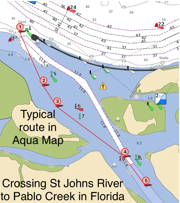 A track is like a crumb trail of where your boat went and is usually just a recording of your boat's progress for any given time period. In the navigation app Aqua Map, it shows as a dotted line on the chart. A route is similar to a track, but it's planned in advance so the captain can follow a path from point A to point B without having to do real-time adjustments for shallow water or other charted obstructions. If you had a successful day and recorded your track, you can send it to others. The same is true for a route if you use an app other than Navionics, which doesn't allow for exporting or importing routes or tracks except to other Navionics apps or partner chartplotters.
I use routes to plan a day's path. I don't necessarily fine tune the route to include every single small turn. I don't publish these routes because I usually make real time adjustments as I proceed. Another type of route available is for passages through specific shallow spots along the ICW. Examples include routes through the shallows south of Fernandina Beach in Florida, Hell Gate in Georgia, Dawho River in South Carolina and many others. They are short routes only through the hazard and they make a lot of turns to follow the deepest water based on my past experience through the area and USACE surveys.
To summarize, I have long routes that I use for general point A to point B navigation and short routes specifically aimed at shallow spots. The short routes are listed on my blog page at the left under GPX Routes with a short description for each. Each route has a time stamp in the title such as BLock121118, which stands for Lockwoods Folly route as of 12/11/2018. The routes can be accessed at GPX Routes. If you use these routes, be sure you have the latest one by looking at the time stamp in the name since I update the routes as new information and surveys come in. At the bottom of the page on the link, there are additional instructions on how to download GPX routes into various apps and programs.
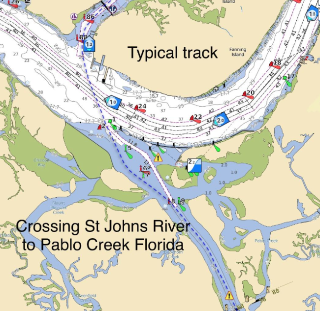
This fall I recorded my tracks as I headed south and made them available at Bob423 ICW Tracks. They are divided into daily segments with a description for each track and mile marker coverage at Track Descriptions. Aqua Map wrote a lead-in for my webpage to display the tracks and provided a download button for easy downloading into various programs and apps, especially
Aqua Map. Instructions on how to download tracks are at Download Instructions. The link is also located under the header for the main webpage. You can see in the graphic that a track is longer than the GPX routes I publish since a track is an entire day's run, not just through a shallow area.
I've accumulated a lot of tracks so to make things easier, I gathered all the tracks into one file as below:All Tracks for Apple DevicesAll Tracks for Android DevicesThe tracks can be followed or just used for reference and can be thought of as a "New Magenta Line" that actually worked for good depth (outlined for each track in the description) this fall. It incorporates all the GPX routes through the shallow area automatically since I went through every one on the way south.
Finally, to help in planning your day, a compilation of Waterway Guide Alerts is given on the download page under, Waterway Guide Shoaling Alerts. I personally keep these alerts up to date with the latest information from USACE surveys, personal data, and high quality reviews by those transiting the areas.
A typical cruising day should include:
1) Plan the route per the weather and where you want to wind up for the night and perhaps a couple of bail out points along the way if the weather is not as expected.
2) Note the mile markers you plan to cover in your cruise for the day
3) With a range of mile markers in hand, check the Waterway Guide Navigation Alerts (see examples in the link) and my list of Waterway Guide Shoaling Alerts for the latest information. Most will also include a GPX route for downloading if desired.
4) Check the tide level through the shallow areas you plan to transit against the MLLW listed in the Alerts above to be sure you have enough depth for your draft. You can fine tune these estimates from the tide tables by noting if there are high winds predicted. An east wind will push water in and raise the water level, perhaps up to a foot or more. A west wind will do the opposite and push water out, decreasing depths by up to a foot. It usually takes winds of 15 kts or more to make a difference in depths. The more wind, the more the effect.
5) Finally, look at the available tracks for the mile markers you plan to cover for the day and consider downloading the tracks. The track can be followed or just used as an additional reference while underway. It's easier to just download all the tracks at once so they are all available for reference by tapping (or clicking on a PC) the files below:
All Tracks for Android Devices
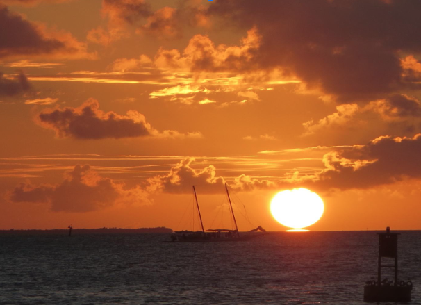
With 1 through 5 done, you are current with all the information on the ICW available. Now go out and enjoy the scenery and the thrill of traveling one of America's greatest waterways and enjoy a great sunset!


- 4,000 Marinas
- Thousands of anchorages
- Updated Charts
- Mile-by-Mile Navigation
- Highlighted Alerts & Cautions
- Full-Color Aerial Photographs

The Waterway Guide App Makes it easy to leave reviews, use our explorer, and view waterway guide materials all on the go!


