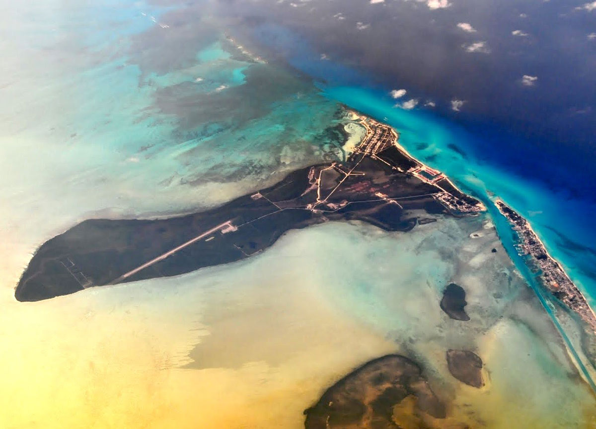
Perched on the edge of the Gulf Stream, Bimini consists primarily of two very closely spaced islands that are separated by a channel that is only 200 yards wide. Most of the population of 2000 live on North Bimini but there are also a few homes on South Bimini, which is the site of the local airport.
Located a mere 45 nm from the entrance to Miami Harbour, Bimini is the closest Bahamian port to Florida and often the first Bahamian landfall for visiting boats. The water around Bimini is especially clear, and the contrast between the deep blue of the Gulf Stream and the iridescent aqua that is synonymous with the Bahamas is stunning.
Bimini has a bigger-than-life reputation for being the playground of painters, poets and pirates. During prohibition Bimini was a common departure point for smugglers who would run across the Gulf Stream in the dead of night to deliver their cargos to thirsty customers in Florida.
Over the years Bimini has developed a reputation as a party spot, and it remains a popular destination for weekends of fishing and partying. While increased entry fees have slowed the flood of sportfishing vessels somewhat, it is still difficult to find a quiet slip at the marinas of North Bimini during any American holiday weekend.
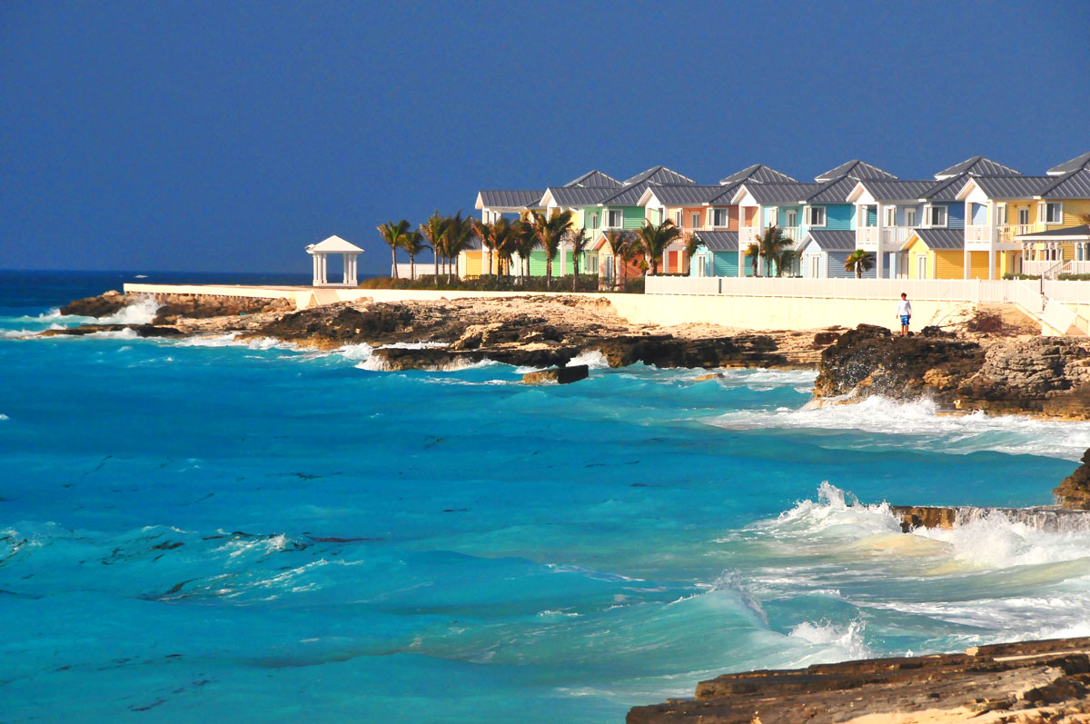
In more recent times the Bimini Bay development on the north end of North Bimini has transformed what were once isolated sand dunes and casuarina trees into a bustling resort of megayachts and casinos centered around a Hilton Hotel. The rudimentary accommodations and burger bars geared towards sportfishing vessels in Alice Town have given way to 5-star hotel suites and fine dining for a very different type of clientele. If you remain south of the resort, the Bimini of old remains and it is still possible to find a reasonably priced slip and a meal that does not require a second mortgage.
For boaters clearing into the Bahamas, Bimini is efficient and hassle free. The Immigration department and Customs are very close together, and the agents are accustomed to handling large volumes of boater traffic so little time is wasted. Once cleared in, necessary tasks such as obtaining local SIM cards, visiting the bank/ATM, or having a celebratory drink can be had nearby. Boaters are an important part of the local economy and T-shirts, flip flops and ball caps are suitable for almost any occasion. For many boaters, Bimini is love at first sight, while others count the minutes before they leave. What is clear is that nobody is indifferent about a visit to Bimini.
Clearing Customs
There are three locations where you can clear in:
- The Bimini Bay Seaplane Dock
- Alice Town – North Bimini
- South Bimini Airport
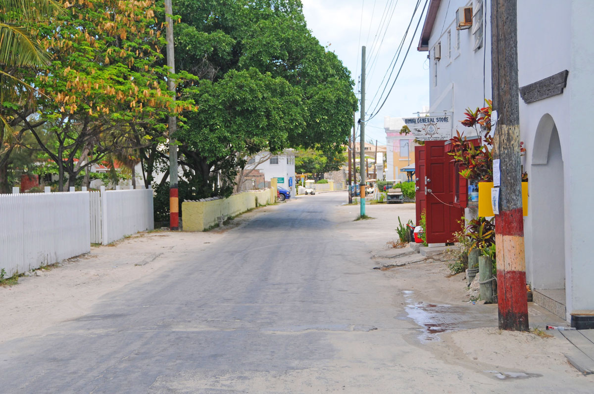
If you are clearing in at Alice Town on North Bimini, you must first make your way to the Immigration office to have your landing cards and passports stamped. The office is in the pink government building 100 yards north of the Bimini Big Game Club.
If you are at a marina, the dockmaster will usually have blank immigration cards, but if they do not, we recommend that the entire crew make the trip to the Immigration department to save time (despite the regulations stating that only the captain should go ashore). If the cards are not available at the dock, you will have to obtain the cards, take them back to your boat, and then return to the Immigration office. If everyone on board goes to Immigration, it will save a trip and nobody will bat an eye.
Once the immigration formalities are completed, only the Captain needs to go to the Customs office at the entrance to the Bimini Big Game Club to complete the clearance procedures. If the Click2Clear forms were submitted and the fees paid, the cruising permit validation will normally take less than 10 minutes. Be sure to request a fishing license and inform the officer if pole spears or Hawaiian slings are on board.
If you go to the airport or Bimini Bay Resort you will be able to complete Immigration and Customs procedures in the same location.
About Bahamas Land & Sea
The Bahamas cruising guide within the mobile app is divided into multiple sections, including "Before You Go," "How Things Work in the Bahamas," and "Geographical Regions." This structure ensures that users have easy access to relevant information, making their journey as safe and enjoyable as possible. As with all of the titles in the Waterway Guide Mobile App platform, content can be downloaded to a mobile device for access when disconnected from internet service.
The guide introduces a distinctive feature of "Chart Briefings." Navionics screenshots are used throughout and annotated with diagrams and notes for in-depth information to assist in situational awareness. In addition, tracks are provided in the form of .gpx files that users can download to their devices or navigation apps to assist in their understanding of locations and local conditions.
Bahamas Land & Sea is available for purchase now inside the Waterway Guide Mobile App.


- 4,000 Marinas
- Thousands of anchorages
- Updated Charts
- Mile-by-Mile Navigation
- Highlighted Alerts & Cautions
- Full-Color Aerial Photographs

The Waterway Guide App Makes it easy to leave reviews, use our explorer, and view waterway guide materials all on the go!


