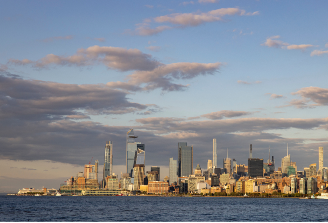
North through The Narrows into New York Harbor–one of the world's finest natural harbors–is the great city of New York with five boroughs and 8.5 million residents. Many superlatives apply to New York City and it is not lacking in boating amenities.
While there are a few possibilities in Manhattan, most of the marinas are found on the New Jersey side of New York Harbor in Jersey City, Weehawken and Hoboken. Ferries and water taxis make the trip on a regular basis back and forth to Manhattan. These large, full-service marinas in New Jersey are close to dining, provisioning, transportation and waterfront events.
Directly alongside the skyscrapers of Manhattan runs the magnificent, scenic East River, twisting its way past the South Street Seaport, beautiful east-side buildings with penthouse gardens and Gracie Mansion, New York's mayoral home. The East River also leads to the cruising Mecca of Long Island Sound.
Cruising Conditions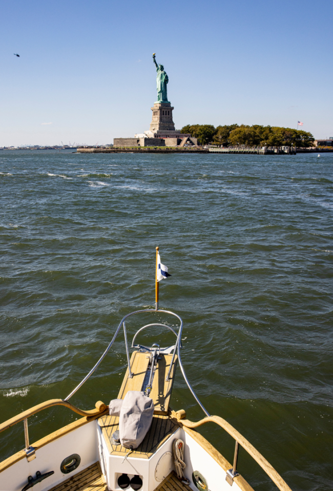
New York Harbor is one of the world's busiest harbors. Ships and barges are always on the move in and out of the harbor, anchoring and docking at piers along the Hudson River, the East River and heading to ports in New Jersey. You will be accompanied by tankers, freighters of all flags, cruise ships, naval vessels, a myriad of tugs and tows and recreational boat traffic, along with continual ferry service to and from Staten Island, New Jersey ports on the Hudson and through The Narrows to ports south. Full attention is required of even the most experienced skippers.
Always give big ships the right-of-way; they have limited maneuvering room. Shipping traffic monitors VHF Channel 13 and do not hesitate to contact any ship or barge if you need clarification on their intention.
New York Harbor waters are deep and well marked. In fog or rain, follow the main channel buoys closely but you can also run just outside of the channel itself in plenty of water and steer clear of big-ship traffic. Compass or GPS courses might be needed to sort out one buoy from another and take extra time at night to be certain of the lights.
Watch for debris throughout the entire New York Harbor area, especially on the outgoing tide. Because of the waterways converging in the Harbor, debris is carried in and out from many areas. Powerboats should slow down to reduce the chance of hitting such objects. Uncertain winds generally require that sailboats use their auxiliary engines when transiting the Harbor; this is definitely the case in the East River. All vessels should monitor VHF Channel 16 and stay alert to traffic that might be just around the corner.
New York Area Security Zones - Cruising & Boating
All navigable waters of the Hudson River are bound by the following points:
- From the point N 40° 46.150'/ W 073° 59.812' on the seawall midway between Pier 92 and 94;
- Northwest to approximate position N 40° 46.233'/W 074° 0.015' approximately 125 yards northwest of Pier 92;
- Southwest to approximate position N 40° 45.945'/W 074° 0.255' approximately 150 yards west of Pier 86;
- East to the seawall between Pier 84 and Pier 86 at approximate position N 40° 45.827'/W 073° 59.968' (NAD 1983); and
- Northeast along the shoreline to the point of origin.
The Coast Guard reports that the following security zones apply to all vessels:
- No vessels are allowed within 150 yards of Liberty Island and Ellis Island or the bridge between the two.
- No vessel is allowed within a 300-yard radius of the Indian Point Nuclear Power Station on the Hudson River at N 41° 16.207'/W 073° 57.270'.
- Any vessel on the Hudson River in the vicinity of Indian Point is subject to random Coast Guard boarding.
- No vessel is allowed within 25 yards of all bridge piers or abutments, overhead power cables and pier and tunnel ventilators south of the Troy, NY, locks.
- No vessel is allowed within 100 yards of all anchored or moored Coast Guard vessels or stations.
Additional restricted areas exist in Port Newark/Port Elizabeth in Newark Bay and around New York City including near heliports, cruise ships, liquified hazardous gas (LHG) vessels, marine terminals and airports. Consult the Coast Guard's Local Notice to Mariners for details.
When special security zones are put into place around the United Nations in the East River, vessels must go through the east channel of Roosevelt Island and under the Roosevelt Island Bridge. Vessels requiring a bridge opening (40-foot closed vertical clearance) should call the tender at 718-361-9217 or on VHF Channel 13 at least 15 minutes before you plan on passing through the lift bridge.


- 4,000 Marinas
- Thousands of anchorages
- Updated Charts
- Mile-by-Mile Navigation
- Highlighted Alerts & Cautions
- Full-Color Aerial Photographs

The Waterway Guide App Makes it easy to leave reviews, use our explorer, and view waterway guide materials all on the go!


