Cruising the "inside waterway" (the ICW) is a bit like driving down I-95. There are areas where every amenity and convenience you need is but an exit away (especially in FL), and then there are stretches with only marsh and woods as far as the eye can see (mostly in SC and GA). And like I-95 there is constant construction, many speed-restricted areas and several bridges to pass under. (The lowest bridge clearance on the ICW is the Julia Tuttle Causeway at Mile 1087.2 in Miami, which is 56 feet.) The main difference between the highway and the waterway is the "road maintenance." With federal funding for dredging being scarce, shoaling has been more commonplace on the ICW and the "projected depths" on the NOAA charts can no longer be considered valid. This, alone, will drive (pun intended) some vessels to take the offshore (Atlantic Ocean) route.
Offshore Runs
Some boaters choose the offshore run to save time or to get a break from the bridge openings and speed restrictions. Many sailboats will take this option to turn off the engine and unfurl the sails. You may be forced to take the offshore route due to vessel draft or vertical clearance. Regardless of your reasons for exiting the inland waterways, there are numerous inlets along both Atlantic Ocean that will allow you to duck in or back out should the weather turn.
Cautions & Warnings
Keep in mind that not all inlets are navigable and some are treacherous under certain conditions. This section will assist you in recognizing those but it is still important to study the charts, pay attention to the weather and seek current local knowledge before proceeding on an offshore run. Be sure to check for a suitable weather window and plan your passage based on inlets with sufficient depth.
Before you begin an offshore passage, take an honest accounting of your vessel, your crew and yourself. Is each of you up to the task? Is the vessel properly outfitted? Do you have the necessary safety equipment, charts, long distance communications gear such as single sideband radio (SSB), an Emergency Position Indicating Radio Beacon (EPIRB) and life raft? Do you and your crew have adequate experience in boating and navigation to attempt an offshore coastal passage?
Check the weather using as many sources as possible. If you have access to weather routing services, they are a good option, particularly for longer offshore passages. You are seeking a weather window with enough space on each side to get you safely out and back in, with room for unexpected contingencies. Of course, always file a float plan with a reliable person. A sample float plan is provided in the Skippers Handbook of this guide. You might also look into the free app BoatSafe Free, which allows you to create a float plan and email it to participants or emergency contacts.
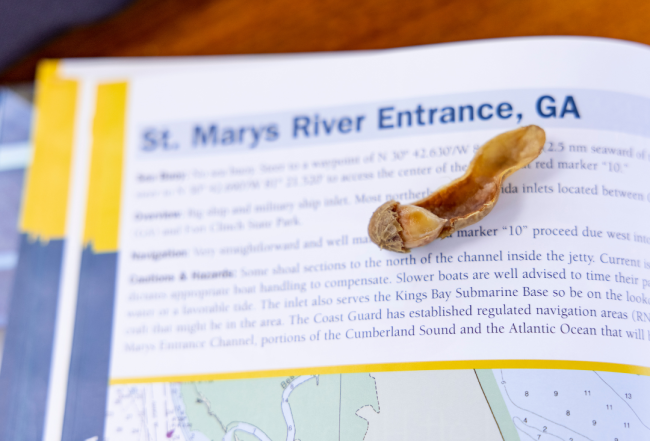
Entering & Exiting
Plan your trip so that you enter in daylight, with the tide, particularly if your boat is slow or underpowered. Remember that wind against tide can create short, steep waves in an inlet that can quickly make even a ship channel impassable for slower boats. If conditions are bad when you reach the sea buoy for an inlet, you may find yourself being driven ashore by wind or waves and unable to find the inlet buoys. It may be better to remain well offshore in rough conditions, possibly continuing to a better inlet.
Be advised that the markers at some inlets are moved on a regular basis and the buoys should be honored. Should you find yourself at an inlet and needing direction, a call on VHF Channel 16 for local knowledge is likely to bring you a response. Sea Tow and TowBoatU.S. are two other knowledgeable sources. The Coast Guard may also be able to assist you, but only if it is indeed an emergency.
Entering & Exiting
Heading north or south, many skippers mistakenly assume that they will shorten their trips by going out to sea and running down the coast. The distances shown here–both inside and outside (from inlet to inlet)–demonstrate that this is not necessarily true. Keep in mind that even if outside distances from sea buoy to sea buoy are virtually the same as the inside distances, the mileage in and out to the buoys adds to the total coastwise figure.
Resources
Prior to your voyage, there are a number of online sources that can familiarize you with the inlets, including the following:
- Waterway Explorer: Provides chart and satellite views of the inlets plus cruising details from local boaters.
- United States Coast Pilot: Nine-volume annual publication distributed by the Office of Coast Survey (NOAA) to supplement nautical charts.
- Local Notice to Mariners: Weekly updates provided by the U.S. Coast Guard to provide corrections to navigational publications and nautical charts.
- Tide Tables: Provided by NOAA to provide tidal predictions (highs and lows) for specific areas.
Mid-Atlantic Inlet Distances Overview:
- From Hampton Roads to Beaufort Inlet: The journey spans 222 nautical miles (nm) via the ocean and 204 statute miles (sm) via the Intracoastal Waterway (ICW).
- Beaufort Inlet to Cape Fear River Entrance: This segment covers 115 nm if traveling by ocean and 105 sm through the ICW.
- Cape Fear River Entrance to Winyah Bay Entrance: Travelers will navigate 65 nm on the ocean route versus 97 sm on the ICW.
- Winyah Bay Entrance to Charleston Harbor Entrance: The oceanic path is 46 nm long, while the ICW route is slightly longer at 58 sm.
- Charleston Harbor Entrance to Port Royal Sound Entrance: Via the ocean, this stretch is 57 nm, compared to 85 sm via the ICW.
- Port Royal Sound Entrance to Tybee Roads Entrance: A short 10 nm on the ocean contrasts with 27 sm through the ICW.
- Tybee Roads Entrance to St. Simons Sound Entrance: Ocean travelers will cover 62 nm, and ICW users will travel 102 sm.
- St. Simons Sound Entrance to St. Marys Entrance: This final stretch is 21 nm on the ocean route and 36 sm on the ICW.
Note: In keeping with standard NOAA conventions, outside (ocean) distances are measured in nautical miles (nm), while ICW distances are measured in statute miles (sm): 1 nm = 1.15 sm


- 4,000 Marinas
- Thousands of anchorages
- Updated Charts
- Mile-by-Mile Navigation
- Highlighted Alerts & Cautions
- Full-Color Aerial Photographs

The Waterway Guide App Makes it easy to leave reviews, use our explorer, and view waterway guide materials all on the go!


