Lake Huron, renowned for its expansive waters that border both the United States and Canada, offers boaters a unique maritime experience. It is part of the Great Lakes system and is particularly famous for its scenic north and eastern shores that include Canada's Georgian Bay and the North Channel, which leads to the St. Mary's River and Lake Superior. These regions are celebrated for their remote beauty and are considered some of the finest cruising grounds in North America.
Quick Facts
- Lake Huron is 206 miles long, 183 miles wide, with an average depth of 195 feet, making it the second largest by surface area and the third largest by volume of water
- Lake Huron is contiguous with Lake Michigan at the Straits of Mackinac with no constraints between the two, leading some to call it Lake Michigan-Huron.
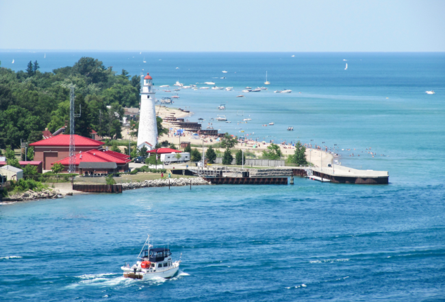
- Along the Michigan side of Lake Huron are numerous ports of refuge, placed 20 to 25 miles apart. The State of Michigan maintains a list of more than 80 harbors and marinas administered by state, county and local governments.
Cruising Conditions & Weather Concerns
It is important that boaters on these waters recognize that annual fluctuations in water level must be taken into account when approaching shorelines and entering harbors. These fluctuations are generally announced on the VHF radio on a regular basis. Because the Great Lakes aren't tidal, there is no diurnal change in depths; however, strong wind and atmospheric pressure differences can produce significant changes.
Note: The U.S. Army Corps of Engineers publishes the water levels weekly as well as a map forecasting water currents. You can also listen to the continuous weather broadcast on your VHF radio. Since the Great Lakes are non-tidal, depths typically change slowly.
- Winds: For the cruising sailor, the orientation of the lake affords favorable winds, which blow predominantly from southwest to northwest, no matter which way you point. Calm morning winds usually increase to no more than 15 knots by mid-afternoon. However, winds out of the south can develop quickly and increase to 40 knots or more.
- Morning Fog: Spring and fall mornings can start foggy but the soup normally burns off before 10:00 a.m.
- Afternoon Storms: Hot June and July days can lead to raging afternoon thunderstorms with locally high winds and waves. Waves outside of the small-craft route are generally about 3 feet in height (1 meter) or less but storms, particularly in the fall, can raise them to 16 feet (5 meters) or more.
Note: Weather forecasts heard on the Canadian VHF channels present land conditions in metric, while nautical conditions are provided in knots. For ease of conversion, a 10-kilometer wind speed is roughly equivalent to 6 mph, or 5.4 knots. Also, each forecast is given in alternating French and English.
VHF Channels
Marinas on the Canadian shore commonly respond on VHF Channel 68 (not VHF Channel 16). The Canadian Coast Guard will gently remind you should you forget and hail on VHF Channel 16. In addition, weather information is given in both of Canada's official languages, French and English. If you hear a broadcast that you do not understand just wait a few minutes. The broadcasts are identical in content, giving you a great opportunity to learn Canada's second official language.
The North Channel Cruisers' Net is broadcast every morning at 9:00 a.m. on VHF Channel 71 from July 1 through the end of August. The Net covers news, weather, location of boats, aids in emergencies and helps with cruisers' needs. The Net can be heard from Beaverstone Bay in the Georgian Bay to the west end of the Whalesback Channel in the North Channel.
Cruising Lake Huron offers a mix of serene beauty and navigational challenges that demand attentiveness to weather changes and proper planning for safe harbor. Whether you're exploring the rugged shorelines of Canada's Georgian Bay or the more populated Michigan coast, Lake Huron remains a top destination for skilled sailors and recreational boaters alike. Stay informed, stay safe, and enjoy the majestic waters of Lake Huron.
Learn more about cruising on Lake Huron in the 2024 Waterway Guide Great Lakes Volume 2.


- 4,000 Marinas
- Thousands of anchorages
- Updated Charts
- Mile-by-Mile Navigation
- Highlighted Alerts & Cautions
- Full-Color Aerial Photographs

The Waterway Guide App Makes it easy to leave reviews, use our explorer, and view waterway guide materials all on the go!


