If you've been anywhere near a boat in the past five years you know that mobile nautical navigation applications have changed the way we plan our trips and pilot our vessels. There are more choices than ever, and the horizon is cluttered with developers and companies vying for downloads in this space. Recreational and pleasure craft operating inshore or in coastal waters are more apt to depend on mobile apps, whether as a primary source of information, or an adjunct to chart plotters and printed charts. All sources are recommended, but mobile apps have reshaped navigational preferences.

Rather than advise which mobile navigation apps are the best, or the ones you should choose, Waterway Guide Media's on-the-water experts have developed a checklist of attributes and questions that you should consider when deciding where you will spend your time and subscriptions. Evaluating and testing apps and electronic charts for well over 20 years, across multiple platforms, has provided our team insight that reveals some important lessons. We have our favorites and have expressed those opinions in past publications. But this article is intended to dive deep into the decision-making process and provide background for your evaluations relevant to existing developments and alternatives.
In addition to cost, time is an important consideration in the decision equation. If the graphic user interface (GUI) of the app is clumsy or not intuitive, then frustration will likely result when trying to figure it out. The layout should meet your needs easily and instinctively. Learning new applications is part of today's digital world. But standards, proven interactive design, and tutorials are essential in effective app architecture.
Designs for Users
Mobile app designers often decide what they think is appropriate without regard to prior charting conventions or the environments or platforms in which the displayed material is presented. These attributes are often different across each app:
- Colors
- Text sizes
- Buoy symbols
- Menu items
- On-screen options
Now that paper charts have almost become relics due to no longer being supported in favor of data delivery, some items may not adhere to a standard in a digital display, including:
- Colors of landmasses and water
- Textual nomenclature of objects
- Fonts
And some items become more subjective in a digital space, such as:
- Depth shading
- Contour separation
- Landmass details
- Objects
- Overall behavior
The sources of vector data for nautical information in the U.S. used by app developers are primarily from the following:
- National Oceanic and Atmospheric Administration (NOAA)
- United States Coast Guard (USCG),
- United States Army Corps of Engineers (USACE).
NOAA's own online chart viewer and custom chart tool use depictions that resemble their legacy printed charts. But all app developers do not employ these standards. Choose any number of apps and you will see different constructs in each of them.
Digital platforms offer endless opportunities to manipulate these options if designers relinquish that control to users. Does the app allow you to change:
- Buoy size
- Text size
- Data display from various sources such as weather and tidal stations
- Overlays
- Contour shading with depth delineation
- Colors
These all can be custom configured in some apps. Confirm that you have the choices you want, and that you know how to employ the menus and settings before finding out later that you don't or can't.

Scaling, Sizes, and Zoom Levels
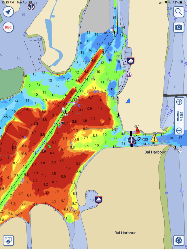
Related to the graphic user interface (GUI) consideration is the way in which a mobile app behaves. Unlike printed charts of yesteryear, digital displays are similar to a three-dimensional chess game. Something is changing, displaying, moving, or resizing each time you zoom in or out. This robust functionality is what makes the digital interface so powerful. But it can also be maddening when you zoom in and a word or aids to navigation (ATON) changes, or you slide the chart one way or another and the text goes away or reveals something anew. Understanding how the ENC behaves and responds to your inputs is crucial to its effectiveness for you. Look at these options and attributes before deciding what you're going to purchase and learn how to use.
Data Refreshing Schedules
Data distribution for Electronic Navigation Charts (ENC) is intended to offer real-time and codified information to any platform that can display it. For the U.S. this means that NOAA's Office of Coast Survey is the source of vector data that has been curated from multiple legacy charts and repositories. USCG also offers considerable data feeds related to aids to navigation (ATON) and safety messages. This transition from paper to digital continues and the background workflow of acquisition, cleansing, staging, and delivery is ongoing. You will see updates every time you view NOAA's, USACE's, or USCG's outputs. What you do not know is how often the mobile app you have subscribed to is updating its database. And many app developers use different criteria for how and when to update.
Packaging at Your Fingertips
The list of data sources that can be configured for display on an app is almost endless. The more robust the app, the more information you will see, including:
- Speed over ground (SOG)
- Course over ground (COG)
- Heading
- Bearing
- Distance to mark
- Velocity made good (VMG)
- Velocity made good to course (VMC)
- Weather
- Waves
- Tides
- Wind
- Notices to mariners (LNM),
- Navigation alerts (MSIB)
- Crowd sourced observations
- Import options for tracks and routes (GPX or KMZ)
- Marinas
- Bridge details
- Automatic Identification System (AIS)
- Auto-routing
- Schedules of when locks open and close
- USACE Survey data
If there is a source of information germane to a skipper, it can almost assuredly be included in an app. Whether the app is doing calculations or serving up information, you must decide what's important to you, how to get to it, and how you want it displayed. You should also confirm that the app developers are committed to keeping the information fresh and accurate.

Questions and a Checklist
With the ease of internet connectivity and reasonable costs of mobile devices, many boaters today employ several apps that they've become accustomed to using, sometimes employing them side-by-side based on features important to their requirements at the time. Having multiple sources of information is also a good idea to cross reference and confirm situational awareness. Remember to keep updating, learning, and exploring your app's user interface to get the most out of it. Here are some questions and a checklist you may want to consider before deciding on which app, or apps, you want to employ on your on-the-water adventures.
Download the printable Marine Navigation App Evaluation Checklist.
Deep Dive Questions for Evaluation of Mobile Applications
□ How often are the base charts and data updated to NOAA base charts? NOAA updates weekly. Does your app?
□ How often are Local Notice to Mariners (LNM and MSIB) updates incorporated? LNMs and MSIBs are weekly.
□ Do the LNM updates in the app include all relevant data and not just buoy locations? (The frequency should be at least weekly)
□ Is crowd sourced data incorporated in a way for easy access and does it include an accurate and reliable source? How old is it? Is it verified before posting?
□ Is tidal information easily found, accessed, and can it be used to predict future tides and currents? Finding the tide or current at a future time is a chore with many apps and programs. Even finding the nearest tide station is not easy except with one or two apps.
□ Are USACE surveys incorporated into the supplier's base charts and how often are they updated? The key requirement for ICW navigation is the display of USACE surveys - there are no substitutes, most reviewers miss this point or gloss over it.
□ Are GPX files easily imported and exported with a maximum limit on points to be 20,000 at least for ease of importing tracks.
□ Does the app or programs connect to the boat's NMEA data via a hardwire connection or over wifi and record the NMEA data into a track or route?
□ Is there an option to display satellite images, overlaid on the chart with variable transparency? Useful for seeing entry into new marinas or to locate landing points for a dinghy.
□ Are weather buoys shown so current information can be seen with a click or tap?
□ Is current weather data displayed and predicted to include wind, currents, and waves? Is NOAA's HRRR used for wind display and prediction?
□ Are Points of Interest (POI) automatically displayed along a route or track with ETAs to each POI with the option to display the POI contents?
□ Can AIS be displayed on the app easily?
□ Can depth data be shared with the Crowd Source Bathymetry NOAA database? (So future charts can be improved)
□ Can multiple tracks and routes be displayed at the same time on the charts? (For planning purposes or when approaching a 2nd route or to compare your track vs a reference)
□ Are boat parameters automatically tracked (gallons of fuel used, boat draft and mast height) used in planning?


- 4,000 Marinas
- Thousands of anchorages
- Updated Charts
- Mile-by-Mile Navigation
- Highlighted Alerts & Cautions
- Full-Color Aerial Photographs

The Waterway Guide App Makes it easy to leave reviews, use our explorer, and view waterway guide materials all on the go!


